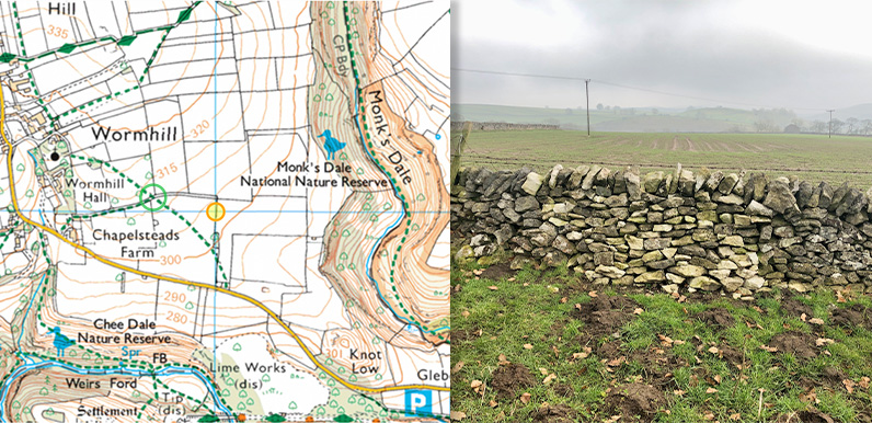
Above: The orange circle on the OS map marks the position of the stone remains.
The photo on the right shows the wall at this exact spot – appearing to have been relaid fairly recently.
The green circle shows the position of the stile with the carved stone step, mentioned below.
I’ve always been intrigued to learn more about the history of Monk’s Dale. Did medieval monks really once walk this way? With its dense undergrowth and ancient stone walls covered in luminous green mosses, it certainly has a ‘place that time forgot’ quality.
I walked the dale in early March (see walk description) when the stream was running alongside the path, adding the tranquil sounds of babbling water to birdsong in the trees. It’s a wonderfully atmospheric spot, but not easy to walk through at this time of year.
14th-century remains
A Google search for historical information highlighted a Wikipedia page which includes these details:
The dale is named after monks of Lenton Priory (a Benedictine monastery in Nottingham). During the 12th-century the priory was granted the income from a large area of north Derbyshire by William Peverel. 14th-century carved stones (of the low septum, or stone screen, dividing the chancel from the nave) are all that remains of the monks’ grange.
I asked on Facebook whether anyone knew where the stones were located and Chris pointed me towards an entry on Derbyshire County Council’s Historic Environment Records which has this brief description, as well as the map at the top of this page:
A fourteenth century stone screen and the outline of the foundations is all that remains of the chapel attached to the Grange of Lenton on the Tideswell side of Monk’s Dale.
This second entry says the foundations are still visible. So with this information, I set out on a misty late afternoon in early March to see what I could find. It’s not far from a public footpath so I was hoping the farmer wouldn’t object.
A complete blank
I found the exact spot marked on the map, but unfortunately drew a complete blank. I checked both sides of the wall and looked further in both directions. But they definitely weren’t there, unless they were buried under the soil.
I did notice that the stone wall where they were supposed to be looked like it could have been relaid fairly recently (see top photo). So I’m wondering whether the carved stones might have been removed at the same time.

There was a small coppice of trees (above), enclosed by the remains of a dilapidated stone wall, just a short distance away. Perhaps this was where the foundations of the monks’ grange had been discovered. But I couldn’t find any evidence on the ground.

I did come across this carved stone on a nearby footpath stile. But it looks as though it’s been in the wall a long time – certainly longer than the historical record. But who knows – perhaps this is one of the missing stones from the grange which was once home to the monks of Monk’s Dale.
I did try to update the historical records with my photos of the wall, but the website wasn’t working. If anyone reading this is able to cast any light on things, please do get in touch by either leaving a comment below, or using the contact page.