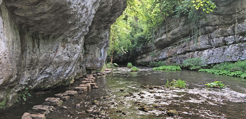
The stepping stones at Chee Dale can be a bit daunting when the water level is high.
Full directions

Click below for a pdf including stage-by-stage details of the route with photos and a map, as well as links to car parks and public transport. A walking app GPX is also available.
Walk details
Length: 3.3mls | Av. time: 1.25hr | Ascent: 115ft
Start: Wyedale car park | Google Map
Walk description, map & GPX | Download
This short walk of just over three miles starts from Wyedale car park, which is beside the A6 to Bakewell, about 3 miles from Buxton. It reaches the Monsal Trail at Blackwell Mill, along a picturesque, tree-lined lane which runs alongside the River Wye.
From Blackwell Mill it’s very much a walk of two halves. The first continues beside the river on a narrow path that can get muddy in winter and after rain. The return is along the easy-going surface of the Monsal Trail.
The walk crosses a fairly long set of stepping stones. These can appear a bit daunting when the river is running high and fast – which it often is after rain and in winter months. But the stones are evenly-spaced with flat surfaces and the rock face is within easy reach for a steadying hand.
Route photos
Stages 1-6 of the route. Click any to enlarge and scroll through.
Relive video
Click to play and use the expand option to view in full-screen. More Monsal Trail Relives.